
Trace a Charles Town Street
A useful street search builds evidence in layers. The parcel map supplies the stable property key, while the deed names the legal owner. Voter records and printed directories can add residence clues, but each has its own date and access rule. That difference matters in Charles Town, where county parcels, city permit jurisdiction, and postal labels do not always cover the same ground. Start with the exact address as it appears today. Keep the house number, street suffix, direction, apartment or unit, postal community, and ZIP in separate fields.
- Enter the address in the Jefferson County Parcel Viewer. Record the parcel ID, district, map, parcel, situs address, subdivision or lot context, and the parcels beside and behind it.
- Confirm the parcel card with the Jefferson County Assessor. Treat the visible owner as an owner-of-record lead, not proof of the current household.
- Take the owner name, legal description, and book and page clues to the County Clerk's Document Inquiry. Read the latest deed and its prior-deed reference.
- For lawful voter research, use the individual state lookup or ask the county elections office what precinct list access is available. The web form cannot list every voter on a street.
- For an older household, compare the address with dated city directories, census schedules, newspapers, probate, and maps. Preserve the year beside every name.
The result is not one master list. It is a Charles Town trail from address to parcel, parcel to title, and dated records to possible occupants. If the question changes from a whole street to one named person, use the Charles Town resident lookup workflow and verify identity across more than one official source.
Charles Town Parcel Search Fields
The Jefferson County Parcel Viewer is the best first screen for a Charles Town street directory search. Its search bar accepts parcel, owner, and address-style input. After accepting the disclaimer, a researcher can zoom along the street, click nearby parcels, change the map view, and print a clean snapshot. The county warns that the map may be incomplete or inaccurate and is not a legal survey. That warning should travel with any saved image.
| Viewer control | Input | How it helps by address | Limit |
|---|---|---|---|
| Find Parcel_ID | Exact parcel ID | Returns to one mapped property without relying on street spelling | Requires an ID from a prior record |
| Owner | Owner name | Locates a parcel tied to a known owner lead | A stable parcel-card result format was not documented |
| Address | Number and street | Centers the map on a situs-address result | Test suffix and number variants if no match appears |
| I Understand | Disclaimer acceptance | Opens the working map | Does not turn the map into a survey |
| Map layers | Basemap controls | Places parcels against streets, imagery, or topo context | Available layers can change |
| Print without basemap | Print command | Saves a clear research snapshot | Still not an official legal map |
The live assessor map shows the address search and disclaimer in context.
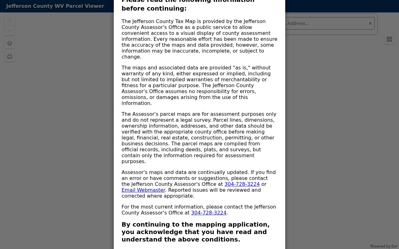
The captured screen is a starting point for street research. Confirm owner, value, tax, exemption, sketch, or mailing details with the Assessor when the live result does not clearly display them.
Note: Save the viewer's update date with each Charles Town parcel snapshot because map layers, ownership inputs, and road data can change.
Charles Town Address Record Layers
Different custodians answer different street questions. Jefferson County holds the land, tax, election, and most recorded title evidence. Charles Town handles municipal permits, zoning, code files, and city maps. Historical material is split among the Clerk, state archives, FamilySearch catalog, library, museum, historical society, and other repositories. A complete address search keeps those channels open when an online form fails.
| Address record | Official keeper | Street evidence | Ways to obtain it |
|---|---|---|---|
| Parcel and assessment map | Jefferson County Assessor | Parcel location, owner lead, district, map and lot context | Viewer, office, phone or email |
| Deeds and recorded plats | Jefferson County Clerk | Legal owner chain, description, prior deed, subdivision and lot | Document Inquiry, Clerk counter, appointment, mail, archive microfilm |
| Tax account | Sheriff's Treasurer Tax Office | Account, tax year, balance and mailing clues when displayed | Vendor portal, office or phone |
| Voter record | County elections and WV Secretary of State | Individual status, party, district and polling place; lawful lists may include address | Name and birth-date lookup, read-only terminal, list request |
| Permits and code | Charles Town Community Development | Site, applicant, permit type, inspection and occupancy events if released | City Hall, MGO application route, records request |
| Historic address sources | Archives, Library, Museum and historical groups | Dated occupants, buildings, newspapers, maps and local context | Online catalog, appointment, staff request or microfilm |
The parcel ID ties the modern Charles Town layers together better than a surname. The legal description and plat carry the same lot across deed books, while an exact street spelling connects permits, maps, voter material, and directories. Ask for nonexempt records under the West Virginia Freedom of Information Act when no routine search exists. A request should name the agency, address, record type, and date span. The law generally calls for a response within five days and permits actual reproduction cost, but it does not make an agency create a new street list or disclose protected data.
Read Charles Town Address Terms
Several words look interchangeable on a record but are not. Misreading them can attach the wrong person to a Charles Town property or move a parcel to the wrong block. Define each field before copying it into a street worksheet.
- Parcel
- A mapped unit of land identified by district, map, and parcel details. One postal address may include more than one parcel.
- Situs address
- The physical property address. It can differ from the owner's mailing address and does not prove who occupies the site.
- Plat
- A recorded survey drawing that shows lots, blocks, dimensions, roads, easements, or subdivision details.
- Criss-cross directory
- A directory arranged by street and house number rather than by a person's surname. No separate Charles Town reverse-directory run was verified in the reviewed sources.
A current Charles Town owner may receive tax notices at another address. An occupant may not own the parcel. A business address in a directory may not be a home. Keep owner, occupant, situs address, mailing address, and source date in separate columns until two records support a match.
Deeds Along Charles Town Streets
The Jefferson County Document Inquiry explanation makes an important distinction: online copies are for convenient review, while the Clerk holds the official record. Use the current owner as a grantee search, then inspect the newest deed for the grantor, recording date, legal description, district, consideration, and the prior deed citation often found in the “And Being” paragraph. Search that seller as an earlier grantee to move backward.
Charles Town street directory work gets harder before the modern index. The county says deed-book images from 1842 through 1919 are available through Image Search but are not indexed by name. This is a real portal gap, not proof that the deed is missing. Work from a book and page citation, legal description, plat reference, tax book, or a later deed's prior-record clause. If those fail, contact the Clerk, arrange access to the appointment-only historical record room, or consult archive and FamilySearch microfilm. Their catalog identifies deeds from 1801 through 1901 and a deed index through 1968, which is a separate layer from the online image run.
Note: A deed proves a recorded title event, not that the buyer moved into the Charles Town property on the recording date.
Charles Town Street Name Checks
Search failures often begin with the address, not the record. The Jefferson County road and subdivision indexes help confirm a current road name, range, route, and map number. The official road roster is dated March 24, 2026. County pages also publish differing 2025 road and subdivision counts, so the date of each list matters more than a claimed permanent total.
The countywide readdressing project ended in August 2008. Outside incorporated municipalities, the county system uses 5.28 feet per address interval, or 1,000 possible numbers per mile, with odd numbers on the left and even numbers on the right. Charles Town may use city-block numbering outward from downtown. An old deed, tax record, printed directory, and current postal address may therefore describe the same land in different terms. Search the full street name, a direction-free form, suffix variants, subdivision name, and parcel ID before deciding that an address vanished.
Postal wording creates another Charles Town trap. The county E9-1-1 ordinance says a USPS postal community can supply the town portion even when a parcel sits beyond municipal limits. “Charles Town, WV” is not by itself proof of city jurisdiction. Compare the postal result with parcel mapping and the city's zoning or annexation map before requesting a permit or code file.
Charles Town Permits by Address
The Charles Town building and code office handles permits, inspections, certificates of occupancy, code cases, and a vacant-structures registry. Permit types include new construction, additions, remodeling, roofing, decks, fences, driveways, accessory structures, pools, plumbing, electrical, and other work. Applications can begin at City Hall or through MGO under Permits & Licensing. The official city pages do not expose a verified public historical search by address, so do not assume every file is online.
Ask Community Development for a specific address, permit or case type, and date range. Planning files can add owner-signed applications, variances, subdivisions, plats, zoning matters, floodplain review, or certificates of appropriateness in a historic district. First determine whether city or county jurisdiction applies. City Hall is the route for Charles Town municipal records, while Jefferson County planning handles county matters. This split prevents a failed request to the wrong clerk.
Map Old Charles Town Blocks
Modern parcel lines only show today's frame. The Library of Congress holds a free October 1885 Charles Town Sanborn map in two sheets. The local Historic Landmarks Commission guide lists later Charles Town Sanborn runs for 1892, 1897, 1902, 1907, 1913, 1922, and 1933. These fire-insurance sheets show building footprints, use, parcel form, and some named businesses or dwellings within the mapped city. They are not full county resident rolls.
The 1885 Charles Town sheet is a useful surprise because the local guide's run begins in 1892. Cite the Library of Congress item and the locally listed run separately instead of forcing them into one continuous set. Earlier local maps from 1852, 1853, 1862, and 1883 can help when a deed uses a landmark rather than a current number. Michael D. Thompson's calendar and index to recorded survey plats from 1801 through 1901 offers another bridge from lot descriptions to Charles Town streets.
Historic district clues narrow the likely building era. Old Charles Town contains many late Colonial and Federal structures, Downtown Charles Town has late nineteenth-century commercial blocks, and South Charles Town includes large late nineteenth- and early twentieth-century homes. Maps and plats can test those clues, but a title record must still establish ownership.
Charles Town Voters by Street
The West Virginia voter lookup requires first name, last name, and date of birth. It can return status, party, political districts, and polling place for one matching voter. It cannot enumerate a whole Charles Town street. The database updates nightly, and a no-match only means the entered values did not produce a result.
For a broader lawful inquiry, W. Va. Code §3-2-30 permits inspection of active, inactive, rejected, and canceled voter records at a county read-only terminal. Printed lists may be available by precinct under county policy. Telephone numbers, email addresses, Social Security numbers, driver's license numbers, and state ID numbers are withheld. The statute also restricts commercial use, solicitation, advertising, and resale. Ask the elections office about scope, format, redactions, update date, delivery, and current charges before planning a by-street list.
Charles Town and Jefferson County district maps help identify a precinct or ward, but they do not establish who is registered at a particular house. Protected voters in West Virginia's Address Confidentiality Program may use a substitute address, so public records may intentionally hide a physical location.
Past Charles Town Street Residents
Printed directories can connect a dated name to a dated address. The WV Archives list verifies Charles Town volumes for selected years from 1965 through 2015, with many gaps. It does not identify the publisher, prove a separate reverse section, or supply a complete local digital run. For the collections, repositories, and entry marks, consult the Charles Town city directory page rather than assuming a surname volume can be searched by house number.
Use the closest directory year, then compare census, deed, probate, obituary, newspaper, yearbook, and map evidence. The Charles Town Library Perry Room is appointment-only and its material does not circulate. The Jefferson County Museum offers photographs and many kinds of archival material, but its online catalog is much stronger for photos than for digitized non-photo records. Staff contact and an appointment remain important access channels. Give a surname, address, and year when asking for help.
A vanished listing has several possible causes: a move, death, missed publication, spelling change, new number, boundary change, or a choice not to appear. It should never be filled with a guess. Record the negative search, volume year, repository, spelling tried, and the next source checked.
Limits of Charles Town Street Records
No public Charles Town street directory proves a complete current household. The Assessor and deed index focus on legal ownership. A tax mailing address may point somewhere else. Voter data covers registered voters and omits protected fields, while children and other nonvoters are absent. Permit applicants may be contractors, agents, or owners rather than occupants. Utility customer accounts are not public people records. DMV addresses are restricted. A historical directory is evidence for its stated year, not the present.
Use public address records for family history, property research, heir questions, scam checks, civic review, or another lawful personal purpose. Verify a claim with the office that keeps the record, especially when a same-name match or stale mailing address could identify the wrong person.
Lawful use. Never use Charles Town address or street records to stalk, harass, threaten, intimidate, or harm a person, and never try to defeat a protected address.
Note: Treat every name-address link as dated evidence and keep owner, resident, applicant, voter, and mailing-contact roles clearly separate.